


Cartography
Terrain mapping is one of the most requested services. Topographic, cartographic plans become obsolete immediately after their creation, as the terrain is subject to regular changes. Geodesy and cartography services allow you to regularly update maps of the area. Services in the field of cartography allow the study of information to identify new objects and their interpretation. Digital cartography has greatly simplified and accelerated the mapping process. New technologies allow the use of modern methods of cartography. Recently, images from space, GIS cartography have been actively used. New methods have greatly accelerated and simplified the process of creating maps.
Cartography tasks:
All work related to the study of the territory is not complete without maps. Even the most detailed description of the area will not replace a map.
Maps are used in the following areas:
construction of settlements;
road network design, hydraulic structures;
development of new territories;
land management and cadastre;
geological exploration;
defense of the state;
elimination of natural disasters and man-made emergencies;
navigation.
Modern technologies make it possible to create maps not only in paper, but also in electronic formats. Mapping services play an important role in socio-economic activities. They allow you to speed up work, reduce the cost of their implementation, and increase profitability. Accurate knowledge of the territory allows avoiding mistakes in design, construction, and other types of work.
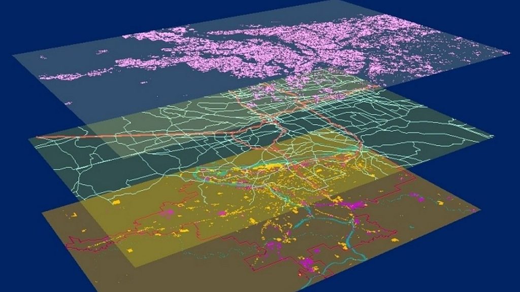
Cartography and remote sensing
In recent years, images from space (aerial photography) have been used as a basis for mapping.
The active use of Earth remote sensing data is associated with the following factors:
the presence of many Earth remote sensing satellites in orbit, incl. ultra-high resolution devices, which allows obtaining data with different characteristics;
increasing positioning accuracy up to 3-4 m;
increased performance, speed of transfer of images;
reducing the time for sending information to the client;
active use of network technologies and capabilities, creation of services that provide direct access to information;
affordable cost of Earth remote sensing data, insignificant information processing costs.
Earth remote sensing data are actively used in cartography; the method is gradually replacing conventional field and other types of surveying.
GIS cartography
The value of good maps remains relevant. Geographic information systems have made certain changes in the field of cartography. Web GIS allows to create and publish maps for public access. Creating of GIS is considered the only way to share the work with others. Electronic cartography has significantly expanded the capabilities of users, such maps can be downloaded to a smartphone or tablet.
Modern technologies are characterized by a systematic approach. The tools provide the most visual display of information. Mapping technologies are used to create electronic relief maps.
The space research and technology agency under the Ministry of digital technologies of the Republic of Uzbekistan — “Uzbekspace” agency info@uzspace.uz uzkosmos@exat.uz 4, Ibrohim Muminov str, Mirzo Ulugbek district, Tashkent
 Show on map